The Norman Trail around York
Thursday 29th February 2024
Something a little different for me this morning, after the morning dog walk and breakfast I drove up to York for a walk around the city centre following ‘The Norman Trail’.
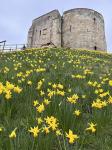
The Norman’s invaded Britain in 1066, at that time York would have been a city with a Viking heritage, controlled by the Anglo Saxons. William the Conqueror (The King of the Normans) wanted to stamp his authority in York and began building a wooden castle in 1068 on the site of what today is Clifford’s Tower.
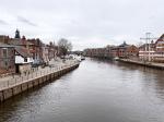
The same year the population rebelled and in 1069 William decided to build a second castle on the western bank of the River Ouse, now called Baile Hill, the purpose being to control river access to the city, thus preventing river traffic along that part of the Ouse.
In 1070, King Swein of Denmark’s warriors sailed up the River Humber and with the powerful Anglo-Saxon nobles, attacked the Norman Garrison. In a defensive measure to prevent their enemies sheltering in the city, the Normans set fire to it. The fire was significant, and much was destroyed including the fledgling Minster.
On hearing of his garrison’s defeat in York, William headed north. He bribed the Danes to leave the city and as he advanced to York he arrived without any opposition. Having restored both the castles he used the city as a base to remorselessly lay waste to the region in what has become known as the ‘Harrying of the North’, he adopted a ruthless strategy of systematically destroying large parts of the north. Norman soldiers stormed villages, killing many, burning fields, and destroying livestock and food stores. William commanded that all crops, herds, and food be burned to ashes, depriving the region north of the Humber of sustenance. It was estimated that 100,000 people died from the violence and famine. It took several generations for the region to recover.
William stayed till Christmas 1069 and by 1072 both his castles had been reconstructed. In 1190 the wooden keep was set on fire during the massacre of the Jewish population of York. In 1244 King Henry111 had the tower rebuilt in stone.
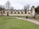
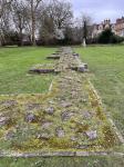
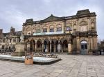
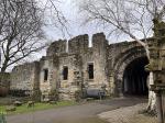
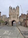
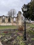
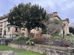
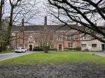
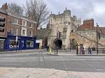
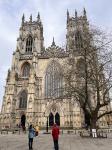
I started the walk in Museum gardens and the ruins of St Mary’s Abbey, Benedictine monks completed the abbey in 1088, Today the walls around it are the best-preserved section of the wall from the Norman times. After leaving the ruins of the abbey I headed past the Yorkshire Museum and next to it, set back is the abbot’s house, today known as the King’s Manor. The house was the home of the abbot of St Mary’s. The current house dates from 1483 and survives as the King’s Manor because it became the seat of the Council of the North in 1539, the King’s Council was set up by Henry V111 to keep a closer eye on the north. Leaving the King’s Manor I headed into Exhibition Square, the home of the City Art Gallery, on the opposite side of the road stands Bootham Bar, its arch dates from the Norman times. Continuing along High Petergate you soon arrive at York Minster. The Anglo-Saxon minster was badly damaged in the fighting with the Normans. When William the Conqueror took York, he appointed Thomas of Bayeaux as his new Archbishop, he repaired the church only to see it ruined again in 1075 when the Vikings invaded. A new church was built by Archbishop Thomas on land that had been the Roman principia of the fortress, The new church was 110 metres long with walls 2.1 metres thick and taken just 20 years to build, it was visible for miles around and testament to Willam the Norman king.
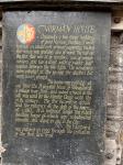
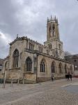
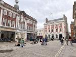
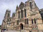
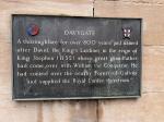
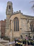
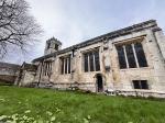
The ‘new’ Minster which stands in front of me today was started in 1291 by Archbishop Walter Grey and took 250 years to complete. Some of the remains of the old Norman Minster can be seen in the Undercroft Museum of today’s Minster. On leaving the Minster I followed the road across Minster Yard and into Stonegate. I stopped at the passageway between 52 and 54 Stonegate on the right, it was here in 1939 that the two houses were demolished to reveal York’s oldest house dated back to the 12th century. Leaving the oldest house, I continued along Stonegate and turned left on to Davygate and St Helen’s Church. A blue plaque on the wall of the church explains that ‘a thoroughfare existed here for over 800 years and named after David, the King’s Lardiner in the reign of King Stephen (1135) whose great grandfather had come over with William the Conqueror. He had control over the nearby Forest of Galtres and supplied the Royal larder therefrom’.
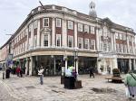
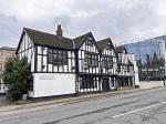
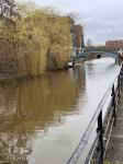
Continuing along Davygate, passing Betty’s Tearoom on the right, I crossed St Sampson Square and along Parliament street. I turned left at the end of the street, just past the Marks and Spencer store and onto the Pavement, passing Lady Peckett’s Yard and Herbert’s House, this road runs into Peaseholme Green, where, on the left stands St Cuthbert’s Church, the oldest church in York after the Minster, which dates from the Norman times. After passing the church I continued along Peaseholme Green to the traffic lights and turned right onto Foss Islands road. After about half a mile I passed the Red Tower on my right. It was in 1068 when William the Conqueror decided to dam the River Foss (on the right) in order to flood the moat around York Castle, the area where I am currently standing became known as the King’s Fishpool. The Red Tower was constructed as a look out post. From the Red Tower I continued along Foss Island Road turning right into Walmgate and into the city centre. From the Coppergate centre I walked across the car park to Clifford Tower, one of the most iconic landmarks of York. The original tower, built in the Norman times would have been built out of wood, and used as a food and weapons store. It was the Normans who invited the Jewish people to England to help them finance their interest. By the 12th Century resentment amongst the Jewish community was growing due to the debts that people had incurred to them. Benedict of York was killed by a riotous mob in London, unrest and rioting broke out in some of the country’s major cities, including Norwich, Stamford and Lincoln. The York mob burned down Benedict’s house killing his widow and children. The rioters saw the riots as an opportunity to wipe out their extensive debts. 150 Jewish people fled to York castle and sought sanctuary from the constable in the tower. The constable turned against them, and a group of knights arrived to lay siege to the tower. With a violent mob outside the trapped community saw no other option than to commit mass suicide and set fire to the wooden keep in order to take their own lives. Those who asked for mercy from the mob were refused and murdered by the rioters. No individuals were ever punished though the city was fined by King Richard. A plaque to the left of the steps leading to the tower entrance reminds you of those individuals who perished in the fire.
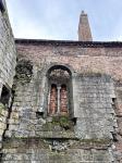
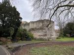
After leaving Clifford Tower along Tower street, I headed across the road and over Skeldergate Bridge. A small turret on the right takes you up some steps to the entrance of the city walls and the site of the motte of Baile Hill. I continued along the walls till I reached Micklegate Bar, thought to be Norman, passing through the Bar and past Holy Trinity church on the right. Before the conquest, a Minster stood on this site, complete with canons, alas by 1089 it was reduced to nothing. Alien Benedictine monks arrived, and a Norman monastery church was built here. Within the monastic complex there was a famous chantry chapel under the priory named the chapel of St James on the Mount. This church is all that survived the monastic complex due to Henry V111’s dissolution of Monasteries between 1536 – 1541. The church was allowed to continue and is the only parish church which was once Monastic, Unfortunately today, all that survives of the Norman church is the nave, which over the centuries has been reduced in size. After leaving the church I continued along Micklegate, turning left onto George Hudson Street, then right onto Station road, leading onto Museum Street and back to my starting point at Museum Gardens. The end most interesting, informative, and enjoyable walk. In summary, the Normans left an indelible legacy in York, transforming it from a Viking stronghold to a thriving centre of culture, religion, and commerce.
|

